Customer story: Using helicopter geoscanning in the Himalayas for tunnel pre-investigations
EMerald Geomodelling assisted NHIDCL in conducting geoscanning surveys to unveil ground conditions in the alpine regions of India.
Background
Some of the world’s most challenging roads can be found in the Jammu and Kashmir regions of the Himalayas. Many roads here are closed in the winter, and Indian authorities currently use helicopters to secure supplies to these areas. Today, the 400 km road from Manali to Leh across the Himalayas is one of the most unsafe roads in the world. National Highways & Infrastructure Development Corporation Ltd. (NHIDCL) has therefore launched a comprehensive program of road and infrastructure development projects to secure the two main routes between central parts of India and the northern part of the Himalayas.
NHIDCL engaged EMerald Geomodelling through NGI, to conduct geoscanning surveys to unveil ground conditions in the alpine regions of India.
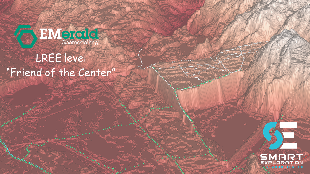
How it was done
The plan was to build two tunnels between Srinagar (Jammu Kashmir) and Leh (Ladakh), and three tunnels between Manali in Himachal Pradesh and Leh are to be built. The Modi government has fast-tracked work on the project to build an alternate route to Ladakh from Himachal Pradesh. The strategic infrastructure project involves the Shinku La Pass, where a 13,5 km tunnel is proposed on the Manali - Leh route, by the NHIDCL.
EMerald Geomodelling ́s technology was used to retrieve information about the complex geology in these areas and overcome the challenges of site investigations. The method consists of geoscanning the area, integrating strategic drillings where available, and applying machine learning to make sense of the sub-surface conditions. The extreme conditions in the mountains were causing several challenges for normal helicopters to fly at this altitude. To be able to fly surveys, the Indian Air Force provided both pilots, Chinook and MI-17 helicopters for the geoscanning. The flying was done in 5 days.
Deliveries to customer


Customer results and actions taken
The complex Himalayan geology is challenging to predict from the surface. The geoscanning revealed important information about 3D structures of competent and weak rock units and their location with respect to the tunnel alignment.
It is the first time helicopter geoscanning is being used in India for surveying ground conditions for tunnels. This makes it possible to generate geological engineering models. With these, a solid decision basis is available for further planning of road routes and safe transport throughout the year. EMerald Geomodelling along with NGI’s tunnelling experts provided information for the construction of four tunnels with a total length exceeding 50 km. The areas range from deep valleys to high mountains, with the highest road pass being 5,500 meters above sea level. Model delivery was fast-track tunnel by tunnel throughout the project in 2020. These models are available for the detailed design phase and updateable when intrusive investigations become available.
“Planning, designing and maintaining infrastructures in the Himalayas is a challenging task, and we are looking forward to implementing these innovative Norwegian techniques supporting our overall aim: projects with high efficiency”
Sanjeev Malik, Late executive director of NHIDCL.